
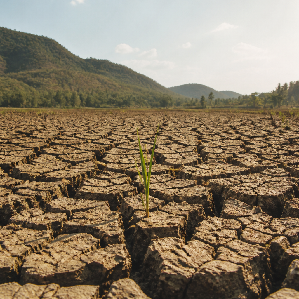
Super El Niño Impacts in the Philippines
This three-lecture audio course examines the 2023-2024 Super El Niño, the strongest El Niño event in the past half-century, and its sweeping consequences for the Philippines. The first lecture establishes the science: how weakened trade winds, a displaced warm pool, and sea-surface temperatures more than two degrees Celsius above average in the Niño 3.4 region disrupt the Walker Circulation, suppress the habagat monsoon, and produce heat indices past forty degrees Celsius alongside rainfall deficits exceeding fifty percent in central Luzon. The second lecture turns to the history of forecasting failures, tracing how 1990s models calibrated for ordinary El Niño events underestimated heat and overestimated moisture transport, urging farmers toward water-intensive crops. It covers the 2009 breakthrough when PAGASA and the International Research Institute for Climate and Society introduced the Super-El Niño Index, weighting anomalies above two degrees Celsius to flag drought risk months in advance and trigger water conservation, adjusted planting schedules, and health advisories. The final lecture stages a structured debate between two experts using the same climate dataset: an agronomist citing drought-resistant rice trials in Central Visayas that cut losses by thirty percent, and a water-resource engineer whose flood-drought models show that a twenty percent increase in reservoir capacity halves water-stress days nationwide. The discussion weighs speed, cost, and scalability, asking whether seeds or infrastructure better protects lives and livelihoods when the next super event arrives.
When the Sun Stays Too Long: The Birth of a Super El Niño
When the Sun Stays Too Long: The Birth of a Super El Niño
The water pipes went quiet in Metro Manila before anyone was ready for it. Rationing had begun, irrigation canals to twenty-seven thousand hectares of farmland had been cut off, and officials were watching a reservoir fall toward a level no one wanted to see. That was the nineteen ninety-seven to ninety-eight El Niño, and it took years to arrive. Now, RH, I want to show you how a drought like that actually starts — because it begins thousands of kilometers away, in the middle of the Pacific Ocean, long before a single Filipino farmer feels the sun.
Start with the ocean as it normally behaves. Easterly trade winds push warm surface water westward, so the western Pacific near Indonesia runs warmer than the eastern side near South America. NOAA points out something that genuinely surprised me: under typical conditions, the sea surface near Indonesia can stand about half a meter higher than near Ecuador, like a bathtub with water sloshed toward one end. The normal temperature contrast across that basin is roughly eight degrees Celsius. So what happens when you, well, when you weaken the winds? The warm water slides back east, the cold-water upwelling near the Americas fades, and the eastern Pacific starts to warm. That is El Niño taking shape.
So, which is why scientists watch one patch of ocean so closely. NOAA's operational index flags El Niño when sea-surface temperatures in the Niño three point four region run at least half a degree Celsius above average for five overlapping three-month periods, alongside real atmospheric evidence. Think of it like a fever threshold — the ocean has to hold that warmth, not just touch it. And there's no single universally applied line that makes an event "super"; the label is just what people say when an event is exceptionally strong. What gets me is the mechanism behind that strength. It's called the Bjerknes feedback: weaker trade winds favor eastern warming, and that warming further weakens the winds. A loop, feeding itself. The wind weakens the ocean, and the ocean weakens the wind. That runaway loop is what separates a super event from an ordinary one.
El Niño is an ocean-atmosphere event — warming alone isn't the whole story, because circulation and rainfall patterns shift too. As the warmest water and its rising air move east, places like Indonesia and the western Pacific often receive less rain. For the Philippines, that means a raised risk of below-average rainfall and drought, though not every province goes dry at the same time, and no two events play out identically. One thing to be careful about: El Niño tends to steer tropical cyclones away from the Philippines, yet the storms that do form can still hit harder. The steering and the intensity are two different questions, and people often, I mean, they often blur them together.
Let me bring this back to that reservoir. Angat supplies Metro Manila's drinking water, and it also supports irrigation and power generation. During the ninety-seven to ninety-eight event, the International Research Institute for Climate and Society reported that its average level in the critical months reached about thirty-two percent of normal — roughly a third of what the city depends on. Agricultural and fisheries productivity fell by six point six percent. And the damage stretched past farms into fisheries, water supplies, power, public health, and natural resources. That's the payoff of understanding the mechanism. El Niño returns on average every two to seven years and typically lasts about nine to twelve months, so the cycle will come around again. What the Philippines built after earlier droughts — monitoring systems, early warnings, PAGASA's province-based advisories — exists because someone watched the wind die down over the Pacific and knew what was coming next. The rain doesn't just fail. Something, far away, takes it.
When the Forecast Misses: How Misreading the Ocean Cost Lives
Speaker 1
Picture a farmer in Luzon who plants rice because the official forecast promised rain. Then the sky gives him nothing for months. That's what breaks when the forecast is wrong.
Speaker 2
That's exactly the right place to start. And in the nineteen nineties, that's what happened. Meteorologists kept watching Luzon's rainfall numbers come in far below what the models said.
Speaker 1
Below what the models said? So the anomaly was visible on the ground but not in the forecast.
Speaker 2
Visible, yes. Understood, no. The models were calibrated for ordinary El Niño events. A super event pushed the ocean past everything they'd been tuned to.
Speaker 1
Wait, so which part of the ocean were they misreading? You said something about satellite data being—
Speaker 2
Right. There was a satellite record of sea-surface temperatures that got ignored in those forecasts. The western Pacific warm pool, the region that matters most for Philippine rainfall.
Speaker 1
And the difference between a regular event and a super one — is that a temperature line?
Speaker 2
Two degrees Celsius above average in the key ocean region. That's the threshold that separates a super El Niño from an ordinary one.
Speaker 1
Two whole degrees.
Speaker 2
And the old framework, the traditional ENSO view, treated warming as a moisture story. More warmth, more rain. So forecasters overestimated moisture transport and underestimated the heat.
Speaker 1
Which is backwards for the Philippines, because the warm pool moving east means the rain moves away.
Speaker 2
Exactly. The heat indices climbed past what anyone planned for, while the promised rain never arrived. The physics was there. The interpretation wasn't.
Speaker 1
So what did farmers actually get told? Concrete, what was the advice?
Speaker 2
The forecasts urged them toward water-intensive crops. Rice, things that need flooded fields. Think of it like a doctor prescribing the one medicine the patient is allergic to.
Speaker 1
Oh no.
Speaker 2
When the drought hit, those crops died first. Fields planted on a promise, with no irrigation backup. That's the human cost of a modeling error.
Speaker 1
But hold on — how do the models built for El Niño end up being the ones that fail? That's the part I can't get past.
Speaker 2
It is counterintuitive. But those models had only ever seen ordinary events. They'd learned that a little warming means a little shift. So when the anomaly ran past two degrees, they just... extrapolated the familiar pattern.
Speaker 1
So they were confident precisely because they'd been right before.
Speaker 2
That's the trap. Confidence from ordinary cases became overconfidence in an extraordinary one. Which is why someone had to build a tool that treated super events as their own category.
Speaker 1
And that's the index, right? When did that happen?
Speaker 2
Two thousand nine. PAGASA, the Philippine weather service, worked with the International Research Institute for Climate and Society to introduce the Super-El Niño Index.
Speaker 1
So what does the index actually do that the old models didn't?
Speaker 2
It weights sea-surface temperature anomalies above two degrees Celsius, so the amplified signal of a super event stops getting smoothed away. The ocean's fever gets read as a fever, not a mild warm spell.
Speaker 1
And once it flags high drought risk, what happens? Who moves?
Speaker 2
Four things kick in. Water conservation measures. Adjusted planting schedules. Health advisories for heat and waterborne disease. And early drought warnings to provinces while there's still time to act.
Speaker 1
So the farmer who got told to flood his fields now gets told to shift his calendar instead.
Speaker 2
That's the difference. And notice — these are fast, seasonal actions. The longer-term debates, reservoirs, irrigation infrastructure, crop research, those come later and move slower.
Speaker 1
So the index buys time, but it doesn't build anything?
Speaker 2
It buys months. A farmer can change a planting season in a month. Nobody can build a dam in one. Both matter, but they're on different clocks.
Speaker 1
Which is why the forecasting failure stings so much. The fix wasn't a new satellite, it was—
Speaker 2
Attention. Reading the record they already had, and weighting it honestly.
Speaker 1
So take me back to that farmer. Same event, but with the index in place.
Speaker 2
He hears a drought warning months ahead. He plants something hardy, stores water, watches the heat advisories. His harvest shrinks maybe, instead of vanishing.
Speaker 1
A bad season instead of a lost farm.
Speaker 2
That's the whole accounting. The nineties forecasts cost seasons, incomes, and in the worst cases, lives. Reading the ocean correctly gives that back — one planting calendar at a time.
When Numbers Lie: Debating the Best Response to a Super El Niño
Speaker 1
Fifteen billion pesos. That's the agricultural damage figure people quote for the twenty twenty-three to twenty-four event. But the label attached to it, "super El Niño," doesn't officially exist.
Speaker 2
Correct. NOAA's official terminology tops out at "very strong." The rest of us kept saying super anyway, and the number followed the nickname.
Speaker 1
So the number is real but the name isn't. That feels like a warning about this whole debate.
Speaker 2
It should. Because today's argument is two experts, one dataset, opposite prescriptions. An agronomist and a water‑resource engineer.
Speaker 1
And I already want to pick a side. Seeds versus dams — that's the fight, right?
Speaker 2
Slow down. Pick a side after the evidence, not before. That's the whole point of testing both on the same numbers.
Speaker 1
Fine. The agronomist's view. What does she actually claim?
Speaker 2
Drought‑resistant rice varieties can cut losses by about thirty percent, even under heat indices above forty degrees Celsius.
Speaker 1
Thirty percent while that hot? Who verified that — her own trials, or someone independent?
Speaker 2
The evidence she leans on is the Central Visayas pilot during the twenty sixteen‑to‑seventeen aftermath of the strong event. The pilot used a drought‑resistant rice strain, compared with traditional varieties.
Speaker 1
And? Don't leave me hanging.
Speaker 2
The engineered strain held yields near normal. The traditional fields, in the same conditions, fell far short. But before you declare victory—
Speaker 1
Wait. Who ran that pilot? I'm not accepting it until you name the source.
Speaker 2
The International Rice Research Institute, IRRI, with local partners. That's her strongest card — replicated trials, not a projection.
Speaker 1
Okay, that's a real card. So seeds work. Why would anyone argue with that?
Speaker 2
Because Torres is solving the farm. Reyes is solving the country. His models say a twenty percent increase in reservoir capacity cuts water‑stress days roughly in half, nationwide, in areas outside the early‑warning coverage.
Speaker 1
Halves them. So his number is bigger than her number.
Speaker 2
Bigger, yes. Different unit, though. Hers is crop loss. His is days of stress — for irrigation, hydropower, and household taps.
Speaker 1
So the seed can't fill a bathtub in Manila.
Speaker 2
Right. During the 1997‑1998 El Niño, low Angat reservoir levels prompted authorities to ration water for the capital region and to cut irrigation on roughly twenty‑seven thousand hectares. No rice variety fixes that.
Speaker 1
Yeah, that's the crack in her case. Seeds protect the farmer, not the faucet.
Speaker 2
But now find the crack in his case, out loud, fairly. Ensure it's built properly.
Speaker 1
Okay — reservoirs take years. Decades, maybe. And the twenty fifteen‑to‑sixteen event hit sixteen of seventeen regions, more than four hundred thousand farming households. You can't pour concrete that fast.
Speaker 2
Correct. FAO counted roughly four hundred thirteen thousand affected farming households and about one point four eight million tonnes of rice losses. Seeds can reach farmers in a single planting season.
Speaker 1
So the trade‑off is speed against reach. Fast and narrow, or slow and wide.
Speaker 2
That's the joint where each argument comes apart. Torres's fix is quick but can't touch cities or power. Reyes's fix is broad but might not exist yet when the next event lands.
Speaker 1
But wait — didn't some regions with new storage do fine regardless of seed choice?
Speaker 2
That's the twist in the pilot data. Areas with reliable reservoir supply kept yields within about ninety percent of normal, whichever variety farmers planted.
Speaker 1
So the dam did the seed's job.
Speaker 2
When water arrives on schedule, the seed matters less. That seems to capture his point.
Speaker 1
So how do two smart people read one dataset and disagree? Same rainfall deficits, same losses—
Speaker 2
Because the data answers different questions. Torres reads crop trials and sees biology that's deployable now. Reyes reads the stress days and sees systems that fail everyone at once.
Speaker 1
And a national total hides both. That fifteen billion pesos lumps together... what, local crop failure with citywide shortage?
Speaker 2
Exactly. The UNDRR review describes impacts ranging from localized crop failures to that nationwide total. One number, very different villages inside it.
Speaker 1
So the average lies by flattening the extremes.
Speaker 2
And there's more noise. Even a weak El Niño, like twenty nineteen, caused real damage — one study put it around one hundred fifty‑seven million dollars, against three hundred twenty‑seven million for the strong event.
Speaker 1
So strength predicts damage, but weakness doesn't guarantee safety.
Speaker 2
No. And droughts can strike even without El Niño at all — Philippine researchers count a nineteen eighty‑nine‑to‑ninety‑three drought that began in neutral conditions.
Speaker 1
Sorry. So forecasting isn't even the whole safety net?
Speaker 2
A forecast alone guarantees nothing. One rice‑sector study found managers and farmer associations cooperated well on scarce water — but where farmers didn't cooperate, allocation broke down anyway.
Speaker 1
So the response is social, not just technical. Pests too, right — wasn't there something about rats?
Speaker 2
During twenty fifteen‑to‑sixteen, rat infestations hit rice and corn, with yield drops of thirty to forty percent in some badly affected areas. Drought doesn't come alone.
Speaker 1
Great. So the seed has to survive heat and rats.
Speaker 2
Which is why neither expert wins cleanly. The honest reading is sequencing — warnings and seeds now, storage built so the next event meets concrete instead of hope.
Speaker 1
Like what the IRI did with Angat — using forecasts to adjust reservoir allocations ahead of the dry months.
Speaker 2
Yes. Response can begin before impacts peak. That's the model: the forecast buys the season, the seed saves the harvest, the reservoir saves the city.
Speaker 1
The forecast buys the season, the seed saves the harvest, the reservoir saves the city. Okay. So which do I back?
Speaker 2
Whichever is missing where you're standing. And from now on, when someone quotes a damage total at you — ask which villages, which months, and whose faucet went dry inside that number.