
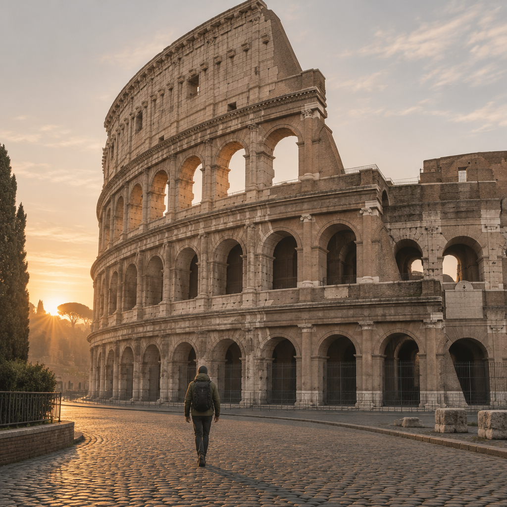
A Guided Tour of Rome I Can Listen to While Walking
This audio course turns a walk through Rome into a structured lesson in urban history. It begins with an orientation to the city's geography and street layout, training you to hear the layers of history in everyday sounds like traffic and church bells. From there, it challenges the popular claim that "Rome never changes," using excavations beneath the Forum, road-resurfacing layers from the Republic onward, and Mussolini's 1930s demolition of medieval alleys for the Via dei Fori Imperiali to show the city as a palimpsest that is constantly rewritten. A lecture on street names traces how the naming system evolved from Giacomo Lauro's 16th-century trade-based labels, through the Papal administration's uniform scheme of 1870, to the municipal catalog of 1924. Later episodes examine Rome's fountains as both civic art and practical water infrastructure, weighing Bramante's view of fountains as monuments against Alessandro Antonelli's engineering reports on water distribution, with the Trevi Fountain's aqueduct remnants and inscriptions as evidence. The course closes with two investigations grounded in physical detail. One follows a single cobblestone from the Via di San Gregorio, comparing basalt quarried in the Alban Hills to a minted coin, tracking guild stamps, wear from traffic, the switch to cheaper limestone after the empire fell, and a hidden basalt layer uncovered during 19th-century restorations to reveal the city's economic cycles. The final lecture debunks the myth that everyone takes the same route to the Colosseum, drawing on 2022 GPS heatmaps, 2018 commuter surveys, and festival crowd-flow reports to show that pedestrian movement is a mosaic shaped by routine, season, and shortcuts rather than a single path. Throughout, each topic is anchored to specific places and verifiable evidence, making the course a practical companion for listeners walking the city in real time.
Welcome to Rome: Setting the Scene
Welcome to Rome: Setting the Scene
Seven fifty-three BC. That is the date the story gives for Rome's founding, when the twins Romulus and Remus supposedly quarreled over the city that would carry one of their names. It's a legend, not a securely established historical date, and that distinction matters more than you'd think. Because the, the thing I keep coming back to is the hill underneath the legend. The Palatine Hill preserves remains of Iron Age settlements, and those traces are tied to Rome's earliest urban core. So the myth points at a real place. And you, Ey, are about to walk across it, along streets that stack centuries like plates in a crowded cupboard.
So how did a modest settlement on the Tiber become the heart of an empire? The river is your first answer. Rome developed on the Tiber, and its banks and crossing helped shape the city's setting. Think of the river as the city's front door and its delivery route at once. Trade, people, and goods moved through that crossing, and the settlement grew into a metropolis from those roots. Rome then became the centre of the Roman Republic before becoming the centre of the Roman Empire. In the fourth century, it became a major centre of the Christian world. That's a, that's a staggering sequence, and it's all written into the ground you're pacing right now.
Now, here's where the Palatine earns its keep as our anchor. In the second and first centuries BC, aristocrats chose that hill as a residential district. Then Augustus, the emperor, put his own home there, and later emperors piled palace complexes on top. Every word palace, in languages across the world, traces back to that hill's name. I didn't expect that when I first read it, honestly. And if you want a glimpse of how the emperors moved through their own home, the Neronian Cryptoporticus is one of the best-preserved underground passages on the hill, linking parts of the imperial residence complex. The hill also hosted civic cults, including the cult of Magna Mater, also known as Cybele. Sacred, royal, domestic, all on one lump of volcanic ground.
Which brings me to the layering, and to a voice that captures it better than I can. The Walking Tour of Italy podcast describes standing in a Roman piazza and feeling every era at once. Have a listen to how they put it.
[[CLIP:ca97d276-91f8-49ca-b13d-2147484670ad:Walking Tour of Italy — A Piazza Across the Centuries:28787]]
"Every layer is still here." That line stuck with me, because the UNESCO listing backs it up. The historic centre was inscribed in 1980 and extended in 1990, and it includes ancient forums, the Pantheon, Trajan's Column, the Mausoleum of Augustus, and the Colosseum, alongside Renaissance and Baroque landmarks like Piazza Navona and Piazza del Popolo. Christian Rome was literally built over parts of the ancient city, reusing earlier spaces, buildings, and materials. Popes took ancient stone and made new churches. Emperors drew the first lines, and that, that is why Rome feels nothing like other European capitals with their tidy grids. The archaeological areas are integrated into the modern urban fabric rather than isolated from it, so your morning espresso sits three steps from two thousand years of history. No pressure on the barista.
And the sounds? The water infrastructure tells you the rhythm. The historic centre includes drainage systems, aqueducts, later fountains, and flood walls along the Tiber, so the splashing you hear at a fountain echoes engineering that has served this city for centuries. The city's surviving monuments bear witness to changing periods of art, architecture, and urban design across more than a millennium. Archaeologists kept digging too. In the 1930s, Alfonso Bartoli established a new Antiquario Palatino, and to expand excavations he demolished a neo-Gothic building a Scot named Charles Andrew Mills had put on the hilltop. Even the, the ruins have ruins, in a sense. Rome doesn't erase its layers, it accumulates them. So walk slowly, Ey. Every cobblestone is a page. And the book is still being written under your feet.
The Myth of the Eternal City’s Unchanging Streets
Speaker 1
So everyone says Rome doesn't change. Streets the same for two thousand years, that whole line. Do you buy it?
Speaker 2
No. And the funny part is, the people who built those streets would be baffled by the compliment. Rome's street network stayed irregular and organic, revised whenever circumstances allowed. Not frozen at all.
Speaker 1
Revised how? Give me an example, something I could actually picture while walking.
Speaker 2
Think of the Via Papalis. The old Via Triumphalis ran as a processional route until the twelfth, thirteenth centuries. Then a roughly parallel new street took over the ceremonial role. The city rerouted its own biggest parade.
Speaker 1
Wait. They moved the pope's procession route?
Speaker 2
Effectively, yes. And flooding plus rising ground levels in the low Campus Martius helped erase the old route. The ground itself moved.
Speaker 1
Okay, but that's medieval. The ancient stuff, the basalt, that's permanent, right?
Speaker 2
Even there, no. The Romans had law about upkeep. The Tabula Heracleensis preserves provisions on street repair, maintenance, and cleaning.
Speaker 1
Meaning what in practice? Who fixed a pothole?
Speaker 2
Property owners. If your building fronted a street, you maintained that stretch, under an aedile's supervision. Fail, and the aedile could hire a contractor and, presumably, bill you.
Speaker 1
No way. Like a homeowners' association with, with actual power.
Speaker 2
With teeth, yes. And the aediles had to ensure repairs stopped water from pooling and blocking passage. Flood control written into routine maintenance law.
Speaker 1
So the streets weren't just scenery. They were, what, a workplace?
Speaker 2
Commercial space, part of the urban economy. And traffic law existed too. Wheeled vehicles were banned during the ten hours after sunrise, with exceptions for building work, public works, rubbish removal.
Speaker 1
Hold on. That assumes the streets even had names to put on a—
Speaker 2
They did. Inscriptions survive, including ones tied to the magistri vici, neighborhood officials whose districts shared names with central streets. Named identities, not an anonymous web.
Speaker 1
Huh. Okay, so my eternal-city claim is leaking. But why does the myth persist?
Speaker 2
Because the change is layered, and layers read as stillness from a bus window. The Appian Way: begun in 312 BCE under the censor Appius Claudius Caecus, extended eventually to Brindisi. Then decline, abandonment, renewal in the fourteenth century, modern restoration.
Speaker 1
So one road had, like, four lives.
Speaker 2
At least. And its surviving paving, those large basalt slabs, that's what tricks the eye. Durable material makes people assume an unchanging city around it.
Speaker 1
Whereas asphalt nearby—
Speaker 2
Different animal entirely. Basalt slabs preserve the ancient grade, the wheel-wear, the road's own history. Asphalt just covers. One is evidence, the other is maintenance.
Speaker 1
So what's the honest metaphor? Not a frozen tableau.
Speaker 2
A palimpsest. A page scraped and rewritten, with the old lines still ghosting through. What survives is fragments. What changes is everything.
Speaker 1
And it kept being rewritten? After antiquity?
Speaker 2
Constantly. The pope returned in 1420, and the Via Papalis became contested ground between local families and curial newcomers. By the mid-sixteenth century it was enlarged, medieval houses replaced by noble palaces.
Speaker 1
SPEAKER_2: Whole streets of houses, gone, for a grander stage.
That's the part nobody says out loud, isn't it. The pretty street is built on, on demolition.
Speaker 2
That's the polite version's blind spot, yes. Renaissance popes straightened streets, built bridges over the Tiber. Sixtus V cut new roads, restored an ancient aqueduct. His Via Felice linked Trinità dei Monti to Santa Maria Maggiore.
Speaker 1
And then 1870 hits. Capital of united Italy.
Speaker 2
Another rewrite. New thoroughfares, Via Nazionale, Corso Vittorio Emanuele. And later, new thoroughfares like Via Nazionale and Corso Vittorio Emanuele were added, and some medieval alleys were removed to make way for wider boulevards.
Speaker 1
So each era tore something to make something. The myth survives because nobody wants to hear that.
Speaker 2
Because the ruins stand so beautifully still. Stillness is an illusion the survivors create. The streets that lost are the proof.
Speaker 1
So next time I'm walking on basalt near some fresh asphalt...
Speaker 2
You'll feel the ground shift. One surface telling you it's ancient, the other telling you it was just re-laid. Both are telling the truth.
When a Tourist Gets Lost: The Puzzle of Rome’s Street Names
Speaker 1
Okay, stop. I've been walking twenty minutes and I swear this street changed its name twice on me.
Speaker 2
Then you've had the classic Roman experience. The names aren't broken, they're, they're sediment. Layers of them.
Speaker 1
Sediment how? A name is a name, right?
Speaker 2
Not here. Think of Via del Corso. Before it took that name it was Via Lata, the urban stretch of the ancient Via Flaminia. Same pavement, new label.
Speaker 1
So who renamed it, and why?
Speaker 2
Carnival races. Pope Paul II launched major celebrations on Via Lata on February 9, 1466, and the races held along the street eventually gave it the name Corso.
Speaker 1
The street is named after a horse race?
Speaker 2
The race, yes. And the renaming kept going. After King Umberto I was assassinated in 1900 it became Corso Umberto.
Speaker 1
Wait, it, it had another name in the twentieth century?
Speaker 2
Two. Corso Umberto, then Corso del Popolo in 1944, then back to Via del Corso in 1946. Politics rewriting the label, twice.
Speaker 1
So my map could be lying to me depending on the decade it was printed.
Speaker 2
Exactly the puzzle. Now, the trade names are my favorite layer, because they're pure memory of work.
Speaker 1
Give me one.
Speaker 2
Via dei Chiavari, lock and key makers. Via dei Falegnami, carpenters. Via dei Baullari, trunk makers, though that street earlier answered to Via dei Valigiari and Via de' Ferravecchi.
Speaker 1
So even one street keeps its old names underneath, like, like the street names have street names.
Speaker 2
That's a good way to put it. Via dei Giubbonari, the corset makers, was earlier Via Pelamantelli, for the wool and coarse cloth men.
Speaker 1
And this confused everyone for centuries before somebody tried to fix it?
Speaker 2
Cartographers tried. Giacomo Lauro's sixteenth‑century maps labeled the streets, but labels on paper can't freeze names people use daily.
Speaker 1
Why not? A map with a name on it seems—
Speaker 2
Because locals don't consult maps. Think of Via Margutta. Until 1600 it was Via dei Nari, after a family that owned property there.
Speaker 1
And Margutta means what?
Speaker 2
Nobody knows for certain. One story says a barber nicknamed Margutte. Another, the surname Margut. A third says it's a contraction of Marisgutia, a foul brook that crossed the lane.
Speaker 1
The top theory is a smelly stream.
Speaker 2
Turismo Roma presents all three as competing possibilities, not settled fact. That's the honest state of it.
Speaker 1
Okay, so when did the administrators actually step in?
Speaker 2
The papal administration launched a uniform reform scheme. It swept away historic titles in the process, and created duplicate street names across the city instead of solving the confusion.
Speaker 1
Wait, the fix made it worse? How, how does uniform naming produce duplicates?
Speaker 2
Apply the same tidy logic everywhere and you get the same names popping up in different quarters. Which is why even longtime residents can fumble directions to Via del Corso. The system and the lived city don't match.
Speaker 1
Sorry.
Speaker 2
That project cross‑referenced ancient itineraries with modern signage and produced a comprehensive municipal catalog. Paper order, at last.
Speaker 1
But does order on paper beat tradition on the street? I'm not convinced.
Speaker 2
It doesn't have to beat it. Both run in parallel now, and digital maps overlay historic names onto modern signs, so a walker hears both layers at once.
Speaker 1
Hmm. So Via Alessandrina, named for Cardinal Michele Bonelli, born in the province of Alessandria—
Speaker 2
And it's the notably surviving evidence of the Alessandrino district, demolished in the 1930s for Via dell'Impero, now Via dei Fori Imperiali. The name outlived the neighborhood.
Speaker 1
So the name sometimes survives. Then I'd say the confusion is the point. The tangled names are the city remembering out loud.
Speaker 2
I'd push back gently. The names are memory, but the memory is contested. Ask a couple of locals which name is real, and you'll get three answers.
Speaker 1
Fine. Then I'm allowed to stay lost a little longer.
Speaker 2
In Rome, lost just means you're reading the older page.
The Two Faces of the Roman Fountain: Art or Utility?
When you pass the Trevi Fountain and look only at its sculpture, you might overlook its functional side. Overlooking that utility can make it harder to appreciate the practical purpose of other fountains you encounter. Because that baroque spectacle, Ey, is a working endpoint of an ancient water system. The Trevi marks the terminal point of the Aqua Virgo, an aqueduct still feeding it today. So the question isn't decoration or plumbing. It's how one object manages to be both, and who argued for which side. And people have argued about this for, well, millennia.
So let me give both views their strongest voice. The art camp points at composition. The Trevi's design combines a palace façade, a triumphal-arch structure, sculptural figures, rock formations, and flowing water, all fused into one theatrical statement. Think of Bernini's Fountain of the Four Rivers in Piazza Navona, commissioned by Pope Innocent X and built between 1648 and 1651. Its sculpture supports an obelisk, turning water into a, a kind of civic triumph. If that's not art, what is? The utility camp just shrugs and asks a simpler question. Where did ordinary people get their drinking water? And that question has teeth.
Now, the evidence. The Roman official Sextus Julius Frontinus kept records of the city's water supply, and he counted 591 public basins against just 39 ornamental fountains. That means for every showpiece, there were roughly fifteen plain, working basins. Picture one ordinary Roman, and I mean literally picture her morning. She probably didn't have water piped into her home. Researchers note that most people likely collected their daily supply from aqueduct-fed public fountains. Her day began at a spout, not at a sculpture. So when Frontinus described distribution, he distinguished display from everyday provision. Both were official policy. The ledger itself splits the two faces.
So how does the machine work? Most Roman aqueducts drew on springs and carried water by gravity alone, no pumps, just a patient slope. The water entered a settling tank called a castellum before flowing out through pipes, which is how you control pressure and grit. The Aqua Virgo was completed by Marcus Agrippa in 19 BCE, serving public works like the Baths of Agrippa. Frontinus even records the legend behind its name: a young girl showed soldiers the springs, and a painting near the spring once depicted that moment. The façade includes reliefs that show the spring’s legend and Agrippa’s role in building the aqueduct. The fountain serves, in a sense, as its own documentation.
And the utility aspect has persisted over time. Three gravity-driven aqueducts, the Acqua Vergine, Acqua Felice, and Acqua Paola, still operate in Rome, drawing on ancient systems or routes. Then in 1874, cast‑iron nasoni appeared under Mayor Luigi Pianciani as a public water initiative. The early ones stood about 120 centimeters tall, weighed roughly 100 kilograms, and had three dragon‑shaped spouts. My favorite detail, honestly, is a trick you can try yourself. Cover the end of a nasone's spout and the water rises through a small hole on top, so you can drink without bending down. That's engineering doing quiet kindness. That morning‑water‑carrier from Frontinus's ledger? Her heir is sipping from a dragon spout.
So back at the Trevi, what changed about how you see it? Nicola Salvi won the commission in 1732, died in 1751, and Giuseppe Pannini finished the fountain in 1762, altering the plan. Salvi, no, the point is, no single hand finished it, because no single purpose defined it. Fountain forms were shaped by their connection to water sources, which means the art and the plumbing were not rivals. The sculpture is the plumbing, dressed for the opera. So when you toss your coin, Ey, you're not saluting a statue. You're saluting a two‑thousand‑year‑old system that is still, this very minute, delivering water. Listen for the splash. That's the sound of both faces talking at once.
The Coin‑Stamped Cobblestone: From Marble to Memory
Speaker 1
Okay, I'm standing on a cobblestone. One stone. Why should I care about it more than the fountain behind it?
Speaker 2
Because that stone is money. Think of it as a coin that was spent face-down into the street and stayed there.
Speaker 1
No. A coin? It's a rock.
Speaker 2
Give me five minutes. The big slabs on the Appian Way, the basolato, are volcanic basalt. Hard, dense, it survives wheel‑wear for centuries. That's why builders prized it, the, the gold standard of road material.
Speaker 1
Where did the gold come from?
Speaker 2
The Alban Hills, mostly. In 2017, a team, Worthing, Bannister, Laurence, and Bosworth, used portable X‑ray fluorescence on 306 lava paving stones. Rome and Ostia drew on the Alban Hills; the middle Tiber Valley used lava from the Vico and Sabatini volcanoes instead.
Speaker 1
So they fingerprinted the stone? Like, like tracing where a coin was minted?
Speaker 2
Exactly like a mint mark. And another study went further, 355 lava stones from Trajan's Forum and the Via Biberatica, all traced to the Alban Hills, two distinct source areas within them.
Speaker 1
Two sources for one city. That's, that's the stone telling you its supply chain.
Speaker 2
Which is your bank‑transfer comparison. Moving tons of basalt from quarry to city wasn't casual spending; it was infrastructure finance, sanctioned at the highest level.
Speaker 1
So who signs the coin, then? Who's the emperor on the front?
Speaker 2
Hand me that one back, because the answer's yours to find in the coinage itself. Roman coins carried portraits and messages, a building, a victory, a virtue. The road carried the empire's face too, just in stone.
Speaker 1
Hmm. Consider the denarius issued by Brutus, the one with the daggers—
Speaker 2
Two daggers and a liberty cap, referencing the assassination of Caesar. A political argument you could hold. Now imagine the Appian Way making a quieter version of the same claim.
Speaker 1
But coins get debased. Did the roads?
Speaker 2
They did. A 2019 study of paving at the Aurunci Mountain Pass found earlier limestone was replaced by lava blocks in the third century CE, likely from the Roccamonfina volcanic area. Limestone to lava, that's an upgrade. But elsewhere, after the empire, cheap stone replaced basalt.
Speaker 1
So the pretty limestone is the devalued currency.
Speaker 2
And underneath it, sometimes, the old hard money still lies buried. Nineteenth‑century restorations kept uncovering hidden basalt layers. The treasury was there all along, just, just covered over.
Speaker 1
What about the wear? A polished cobblestone means—
Speaker 2
Traffic. Like a coin's edges dulling from changing hands. A domed, worn slab saw centuries of wheels; a sharp‑edged one sat in a quiet lane.
Speaker 1
It feels like the Via Appia is a wallet that stays open.
Speaker 2
UNESCO inscribed it in 2024,
Do All Romans Walk the Same Path? Debunking the ‘One‑Way’ Myth
There is one road into Rome and everyone walks it. I used to think, standing near the ancient arena, guidebook in hand, watching the crowd flow past like water in a single channel. The tour guide said it too, confidently. One way in, one way through. The cobblestones told us about money and stone, but today I want to ask them about feet. And the answer, Ey, is not the one the guidebook gives. Because the wear on the stones, the, the actual physical evidence, tells a messier and far more human story.
So let's run this like an investigation. One clue comes from the Arch of Drusus. Researchers looked at the wear on its stones and found evidence of one‑way movement right there, at that specific spot. I thought, there it is, proof of the single path. I was wrong, and the stones corrected me. One‑way at one arch is not one‑way everywhere. It's one intersection with a habit. The second clue comes from Pompeii, where streets survive whole enough to study. And what researchers found, using wear on curbs and posts alongside the wheel ruts, was both one‑way and two‑way traffic, with rules that changed and overlapped over time. Think of it like a modern street that gets a new turn lane every decade. The city kept redeciding.
Now, why would movement split into so many channels? The mechanism is simple once you see it. The ancient city had a dense street network, and a person's journey depended on where they were going and how they traveled. Streets weren't just corridors, they were workplaces, markets, social spaces. So routes bent around activity, not just distance. What gets me is this: the shortest line between two points often wasn't the route anyone took, because buildings and social life sat in the way. And in Pompeii, some property owners could even exclude carts from their streets entirely, sending drivers elsewhere. Suppose you were a cart driver, you'd be rerouted by someone's private gate. Your path was shaped by other people's choices.
Then there's the economics, which is where the body understands what the ledger says. Estimates based on Diocletian's price edict suggest wagon transport could cost many times more than boat transport over the same distance. So people chose between walking, riding horses or donkeys, or taking vehicles drawn by people or animals, and the price tag steered them. For example, a typical full day's journey on foot covered about sixteen miles, while a heavy ox‑drawn wagon might manage eight to ten. Your legs beat your ox, basically, but both lost to a boat. And the road network itself? The Itiner‑e dataset documents roughly three hundred thousand kilometres of Roman roads, full of secondary routes connecting farms and villas, built for military movement and for linking countryside, cities, and ports. Roads alone did not carry the Roman world. Rivers and sea lanes did heavy lifting too.
But does this diversity survive today, on your walk? Yes, and one case proves it. The Seven Churches pilgrimage links seven basilicas across Rome, and it's often mistaken for some ancient traffic rule. It isn't. It began as a devotional practice associated with Philip Neri in the sixteenth century. Vatican News describes participants praying, singing, and reflecting as they walked, a communal route, but one itinerary among many possible ones. Nobody claims every Roman walks it. It's a chosen path, not the path.
So the guide's confident claim collapses against the evidence. Researchers have even found Roman roads were relatively straight where terrain allowed, but less straight than modern roads, weaving around hills, homes, and habits. Which means your own walk through Rome belongs to an old tradition. The one thing I defend fully is this: there was not a single path, but many walkers. So choose yours, Ey, and let the detour be the point. The crowd you're following is just one answer among thousands.